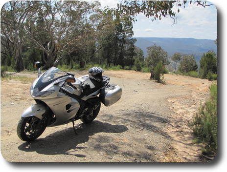
It was time to take the Sprint GT on a test tour, to see how well we fit for the longer haul. In this instance, longer means 2 days, over 500 km each to Dubbo (central NSW) and back. The total ride distance was a bit over 1200km, and the bike has loosened up quite a bit. Both of us survived nicely. The Sprint's riding position is a little more lean forward than my last touring bike, and I wasn't sure how well that would work. Turns out to be not a problem, and I think my back and rear end are happier all round than on the R1150RT I owned in Seattle.
So with improving weather, I choose leathers, but with a rain oversuit in the panniers, just in case.
After making a reservation for the evening, and getting the last room in the motel, it was 10:30AM and time to leave. The ride weather was fine until about half way up the M7, whereupon there was some light drizzle. Not much, so no cause to break out the rain gear. By the time I reached Windsor, the drizzle was looking more like rain. I needed to fill the bike, as the Putty Road does not suffer from a surplus of petrol stations. I missed the petrol stations in Windsor, but pulled in at Wilberforce, the next town along. After filling, the rain jacket was on, and off I went.
It's probably 35 years since I was last on the Putty Road. And that in a car. The first part of the road was in the rain, but even so was quite enjoyable. Considering it was a week day, I was surprised by the lack of trucks. And other traffic, though that perhaps was less surprising, given the wet weekday.
The northern 50km or so was designated a "motorcycle safety zone", with a number of large billboards advising on cornering technique, and the dangers from getting it wrong on such a road. I found them somewhat distracting, as I kept reading them. Just before a corner! However, none of the corners (and there are many) were surprising; the signposting is excellent, and under the conditions, I was not pushing it. It is, indeed, an excellent road to ride. In any weather, including rain and some fog which I encountered.
At some stage, the rain stopped, and somewhere or other I took the rain jacket off. It was bone dry by then.
The Putty Road reaches the Golden Highway, which goes all the way to Dubbo, via Denman, Sandy Hollow, Merriwa and Dunedoo, among many smaller settlements. It was here that I first appreciated how green is the country! So much nicer looking than last time I ventured bush. Coincidentally, the day after I returned, it was announced that the whole of NSW was drought free - the first time in 10 years. And I could believe it.
During my 35 year absence from the upper Hunter Valley, the earth has been (and is still) been reshaped. Huge open cut coal mines are building new mountains from the overburden produced in the mines. It is quite a shock to see, and I understand why the local residents are far from happy about it.
Once on the Golden Highway, the road becomes more mundane, with passing zones, no real corners, and much more truck traffic, at least in the Hunter Valley region. This is also the road which crosses the Great Divinding Range, with maximum elevation about 600m. From there it's downhill to Dubbo, with an elevation of about 220m.
Margaret, my GPS receiver, guided me to the motel driveway, reaching there about 5:30PM. Time to settle in and think about dinner. Not having stopped for lunch (although I had an apple to eat), I was getting hungry. Eventually settled on SSS Barbeque restaurant. It was an OK meal, pretty much to be expected from a mid-market chain. Service was pleasant, atmosphere ok (except for the music - not my choice, and to be honest, not necessary), price OK. Even though it was just a couple of blocks, I rode there. In part because I wasn't sure it would be a place I would choose to eat, and secondly I forget to pack a pair of regular pants to wear.
After dinner, it was time to plan the route back home for tomorrow. Not wanting to ride back the way I came left 2 basic choices. Across the Blue Mountains on Bells Line of Road, or further south and drone along the Hume Highway. The latter route won, as it meant I would be avoiding joining peak hour traffic in Sydney, rather would be travelling against it. And much less of it too. Route decided, a bit of judicious input of towns into Margaret and I was all set for the morning.
After a more than hearty breakfast at the motel (I should remember to not choose something from EVERY section of the menu!), I was on the road a little after 9AM. The day was still a little cool, and thus the heated grips were tested. With a more than satisfactory result - nice warm hands all day, as needed.
The route was south through Wellington (filled the bike there), Molong, Canowindra (I know it's not pronounced how it is spelt, but can't remember the "correct" pronounciation), to Woodstock (yes, really), across Wyangala Dam to Boorowa (filled up again, had a nice discussion with the lady there - asked was I returning from the MotoGP race at Phillip Island (no) and that we both could see no interest in racing of any sort), to the Hume Highway just before the Yass turn off, and on to Sydney, filling up again somewhere around Tahmoor to ensure sufficient fuel to reach home without stopping in Sydney.
Along the way, the road climbs a mountain range, and just after the top is a sign to Elliots Lookout. Being about lunch time, this seemed like a good place to stop. The sign warns of 2km of dirt road, and indeed it is. Not too bad, but with a few ruts from water running across/along the road. Having negotiated the road, there is a pleasant view of the waters of Lake Wyangala.
And I had my apple, and drank some water.
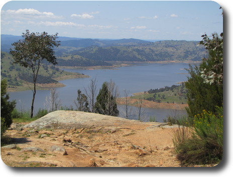 The view of Lake Wyangala. At least there's water in there,
which wasn't the case earlier in the year, when the dam basically
ran dry. It's still far from full, as the next photo shows.
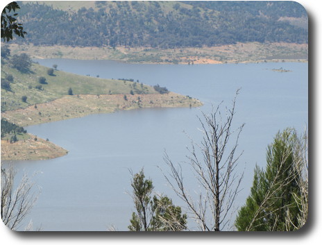 This is a close up of part of the area in the above photo. The brown
area above the water
should
be covered by water. The height of the trees growing in that zone show
how long since it was last covered up.
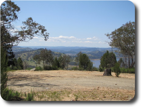 A wider angle view from Elliots Lookout, which is at 700m elevation.
The lookout would probably be described as "rustic"; there are a couple
of tables under shelter, a barbecue pit and a couple of rusted out
garbage bins. However, the view is pleasant. This is looking roughly east.
From here, the road continues across the dam wall. As I looked down to the low water level, the top of an older dam was just poking out the top of the water. And the water was quite some level below the spillway. The NSW storage summary shows the dam with a capacity of 1220 gl when full, but holding only 462 gl on October 18, 2010, or 37% full. And this page has a photo of the dami in early 2010 - quite a comparison with today, though not of the same area of the lake.
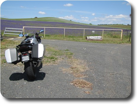 Continuing along, the green country continued. Except for the occasional
yellow field - I presume canola - and more often purple fields.
Eventually I stopped to take a photo, and also a close up of some of
the plants, to try to identify them later. My suspicion was lucerne,
but Paterson's Curse is more likely. Finally this location
came into a view - a place to park off the road and snap some photos.
The property is named
Nutbush.
And it's somewhere between Wyangala Dam and Boorowa.
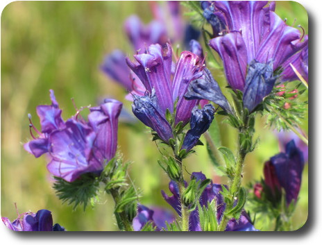 The flowers appear to be
Paterson's Curse, Salvation Jane (South Australia)
and other regional names.
Earlier versions of this page suggested lucerne. There were also quite
a few growing wild along the edge of the road. Hardly surprising.
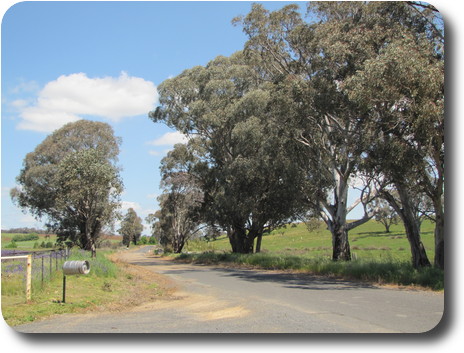 The road outside Nutbush, a very typical Australian rural scene with
eucalyptus trees lining the road, and a barrel for the mailbox.
The road here was in poor condition - but it is a minor road, meaning
there's little traffic (now at least; harvest time is likely quite busy).
From here on it was just a little more of the enjoyable back roads before reaching the highway and the drone home.
Overall, 1200 km in 2 days of quite enjoyable escape.