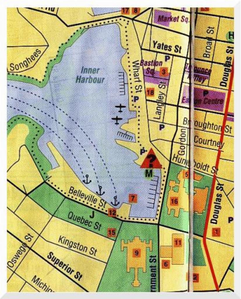

This map is of the inner harbour area of Victoria, the prime tourist area. I was staying at the Hotel Grand Pacific which is not shown on the map, but is located on Belleville Street, to the left of Parliament House, which is number 9 on the map. In fact, the hotel is across the street from the red square containing the number 12 (just below the right most of the three anchors).
The MV Coho ferry docks at the location indicated by the rightmost of the three anchors. I had a suite (free upgrade!) in the hotel, on the top, right most corner, as seen on this map.
The Fairmont Empress Hotel is number 16 on the map, at the right most side of the Inner Harbour.
The Johnson Street Bridge is shown at the top of the Inner Harbour. My walking tour was from my hotel along the waterfront, more or less, to the Johnson Street Bridge, and then a tad further, before returning so as not to be late for Donna and Mark to pick me up for dinner.
Songhees Street is named after the Indian tribe which used to occupy that area. It has been turned into an area of many apartment buildings, which are the subject of great litigation. During the last building boom, many apartment buildings were constructed with less than adequate water proofing, which is bad news in this climate! At least one of the buildings in that area was undergoing major reconstructive surgery.
The local railway, ViaRail terminal station is number 17 on the map, at the right hand end of the Johnson Street Bridge. Although it is now the terminus station, it's tiny. The one train per day, or so, must create quite a bit of excitement :-)