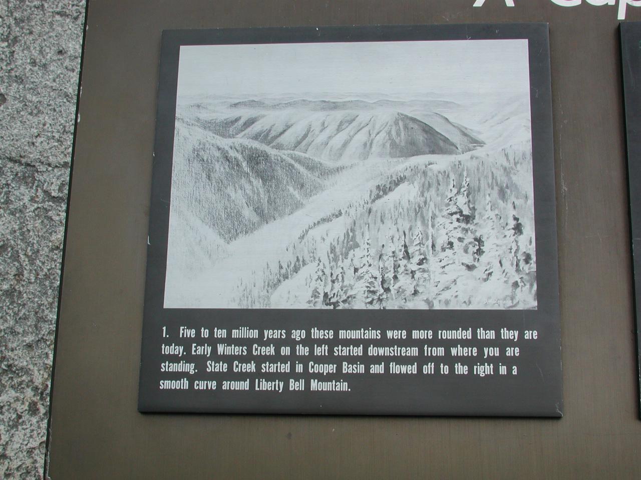

Five to ten million years ago these mountains were more rounded than they are today. Early Winters Creek on the left started downstream from where you are standing. State Creek started in Cooper Basin and flowed off to the right in a smooth curve around Liberty Bell Mountain.

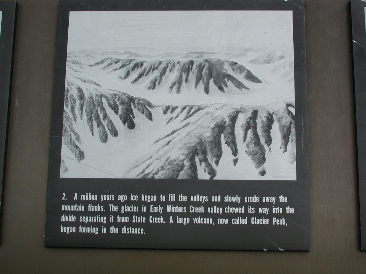
A million years ago ice began to fill the valleys and slowly erode the mountain flanks. The glacier in Early Winters Creek valley chewed its way into the divide separating it from State Creek. A large volcano, now called Glacier Peak, began forming in the distance.

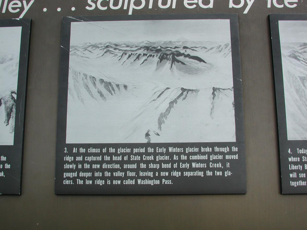
At the climax of the glacier period the Early Winters glacier broke through the ridge and captured the head of State Creek Glacier. As the combined glacier moved slowly in the new direction, around the sharp bend of Early Winters Creek, it gouged deeper into the valley floor, leaving a new ridge separating the two glaciers. THe low ridge is now called Washington Pass.

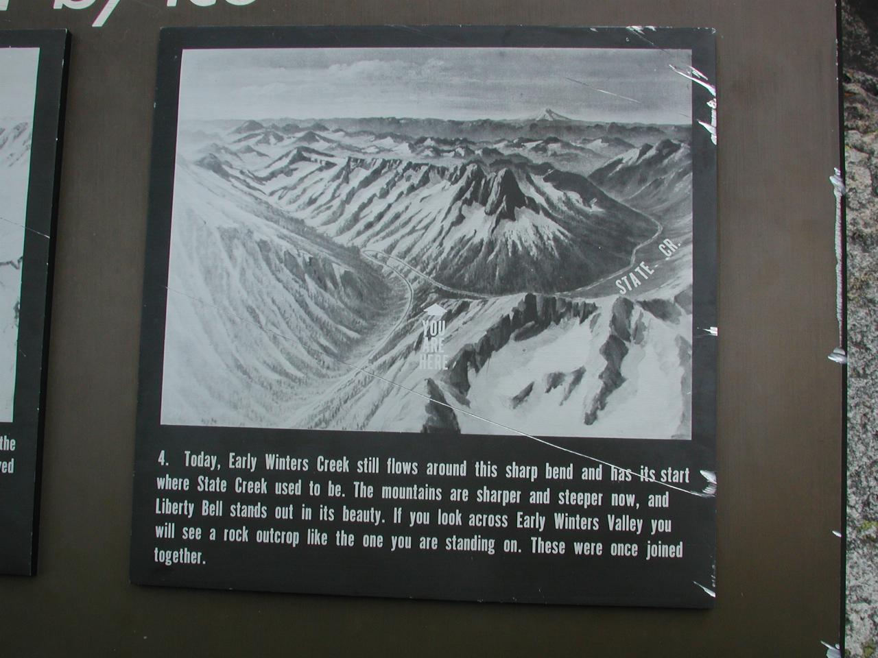
Today, Early Winters Creek still flows around this sharp bend and has its start where State Creek used to be. The mountains are sharper and steeper now, and Liberty Bell stands out in its beauty. If you look across Early Winters Valley you will see a rock outcrop like the one you are standing on. These were once joined together.